
|
|
|
Maryland Washington Dc County Outline Wall Map
By Maps.com
|
|
|
What are rails?
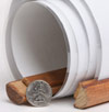
The type of Rails available for this map are wooden dowels that connect to the top and the bottom of the map to help it hang flat against the wall.
The top rail has a thin rope that can hang from a hook or nail.
The bottom rail has a thin rope used to pull the map down.
These rails serve as a hanging option that eliminates the need for tape or pushpins. | 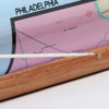
 | | (click on the images for a closer view) |
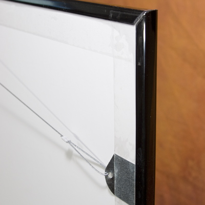
What is mounted?
The type of mounting available for this map features a sturdy custom manufactured foamcore backing surrounded by a soft-line black plastic frame, adding a professional flair to your Wall Map. The foamcore is perfect for pushpins.
The back contains hanging hardware much like a picture frame, with a strong wire that can hang from a nail or hook, helping to keep the map centered.
The sturdy display makes your Wall Map a real working tool as well as an attractive display piece. | 
Frame Closeup | | (click on the images for a closer view) |
|
|
|
|
Product Highlights |
|
Maryland Washington Dc County Outline Wall Map |
|
Item#:
MDC1 SCO MD WA |
|
This Maryland and Washington DC Wall Map contains useful information in a simple easy-to-read format. Ideally suited for business and reference, the Maps.com Simple US State County wall maps are perfect for easily viewing county boundaries, names and seats. This Maryland and Washington DC wall map features: - County Boundaries
- County Names
- County Seats
The Paper version is printed on high quaility semi-gloss paper, perfect for framing.
The Laminated version uses 3mm laminate on both sides for durability, is easy to clean and markable.
These maps are Printed on Demand.
Sizes are approximate and may vary due to the nature of the trimming and laminating processes.
|
|
 |
More Product Details
This map requires 7 business days to print and laminate prior to shipping.
Find it all at Maps.com's Map & Travel Store! We offer the biggest selection of Wall Maps, Digital & Electronic Maps, Travel Maps and Travel Guides, Globes, Atlases, Gift Ideas and more. Easy online ordering, fast shipping and quality products — Maps.com is your online Map & Travel Resource. Need Assistance finding the perfect map? Call us at 1-800-430-7532.
* Pins not included with mounted map.
|
|
Shipping Conditions
Maps.com ships only to US & Canada
 | This product can only be shipped to the Domestic U.S.A. (No APO's or PO Boxes) |  | This map requires 2 business days to print and laminate prior to shipping. |
|
|
|
Best Seller ranking based
on customer purchases.
|
|